
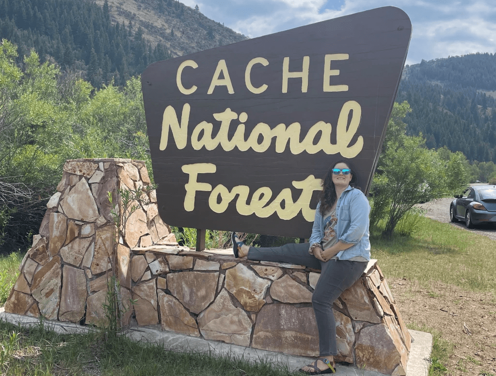
The Bear River Mountains that make up most of present day Cache National Forest run north from Blacksmith Fork Canyon, UT to Soda Springs, ID between the Cache and Bear Lake Valleys. Prior to the arrival of Mormon Settlers, these mountains contained lush forests and meadows inhabited by bands of Shoshone people. In August 1847 shortly after their arrival to Utah, Brigham Young (leader of the LDS church) decided to pursue control over the Cache Valley with the hope that the area would serve as grazing grounds for herds. In 1855, the Utah territorial assembly passed the following legislation, which was signed into law by Young:
Be it enacted by the Governor and Legislative Assembly of the territory of Utah: That portion of country known as Cache Valley… is hereby granted to Brigham Young, Trustee in the Trust for the Church of Jesus Christ of Latter Day Saints and those whom he may associate with him; together with all the products and benefits arising therefrom, for a herd ground and other purposes1.
Young sent a party to establish the region for ranching along with 2,000 head of cattle. Cache valley winters are severe and the effort was abandoned mid-winter, with the party driving the cattle back to the Greater Salt Lake area. Only 420 cattle survived.
The following year, 1856, Peter Maughan and a party went north once more and established Wellsville, becoming the first permanent white settlers in the region. The Cache valley was still heavily utilized by nomadic bands of Shoshone, but the white settlers quickly moved in to displace them. Between 1856 and 1900, over 1,800 white settlers moved into the Cache Valley.
This rapid growth and development in the valley led to rampant logging and over grazing of the surrounding Bear River Mountains. Sheep seemed to do particularly well in the region during the summer months, then were driven down to the West Desert of Utah come winter to avoid the harsher northern weather. Thus, sheep herds from much farther than the Cache Valley were set loose in the mountains and areas were totally stripped before moving on.
By 1902, the situation had escalated and the lack of ground cover led to extreme erosion and the drinking water of Logan was fouled with mud. In February, a meeting for Cache Country residents was called. The residents felt the government should proclaim the Bear Rive Range a mountain preserve to help protect the watershed for the valley. On February 15th, a resolution was passed requesting that the President of the Unites States set aside much of the Bear River mountains as a forest reserve.
William Peterson of the Utah State Agricultural College (now Utah State University) set out to perform a glacial geological survey in the Bear River Mountain range in 1903. He described the devastation of the region as follows:
As I had known the area, the tops of canyons and the high cirques had never been grazed, so I started with a small amount of grain, feeling that I could graze my animals as the work proceeded. I cannot over-exaggerate the conditions found. The first night out my animals were tied up to keep from wandering, because there was absolutely no feed available. I purposely visited the very head of the canyons, those areas which were most generally inaccessible, but greatly to my surprise sheep had been there and had transformed what had previously been a luxuriant growth of grass and flowers into a dirty, uninviting barren spot. Only one night do I remember I was able to graze the animals out and that was by partially building a trail that got the horses onto a ledge where sheep had not been able to climb. This was the only night of actual grazing given to my animals during the six or seven weeks I rode the Bear River range2.
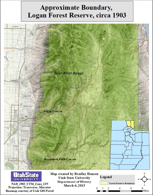
In May of 1903, Theodore Roosevelt visited Salt Lake City to make the proclamation creating the Logan Forest Reserve, consisting of 182,080 acres. It was to be managed by the General Land Office.
An Excerpt of Proclamation 500 – Establishment of the Logan Forest Reserve
And Whereas, the public lands in the State of Utah, within the limits hereinafter described, are in part covered with timber, and it appears that the public good would be promoted by setting apart and reserving said lands as a public reservation
Now, Therefore, I, Theodore Roosevelt, President of the United States, by virtue of the power in me vested by section twenty-four of the aforesaid Act of Congress, do hereby make known and proclaim that there are hereby reserved from entry or settlement and set apart as a Public Reservation all those certain tracts, pieces or parcels of land lying and being situate in the State of Utah and within the boundaries particularly described as follows, to wit …
… The reservation hereby established shall be known as The Logan Forest Reserve.
In Witness Whereof, I have hereunto set my hand and caused the seal of the United States to be affixed.
Done at the city of Washington this 29th day of May, in the year of our Lord one thousand nine hundred and three, and of the Independence of the United States the one hundred and twenty-seventh.
Theodore Roosevelt
Though the number of livestock grazed on the land had decreased by 80% by 1905, conditions were too far gone for a quick fix and water issues still plagued the Cache Valley. More drastic reservation efforts were needed. Also by this time, the General Land Office was embroiled in scandal and the U.S. Forest Service was born and all federal forests were transferred to its care. In 1906, the Logan Forest Reserve was combined with other lands and retitled as the Bear River Forest Reserve, consisting of 267,920 acres. Between 1906 and 1908, some 415,360 acres were added to include the land between the Idaho border and Soda Springs, ID as well as a tract of land west of the Bear River Range. The western portion consisted of the Marsh Creek and Malad divisions, a total of 149,440 acres of land.
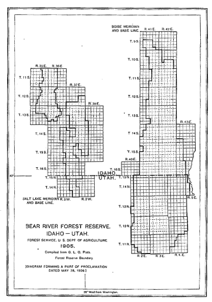
Library of Congress
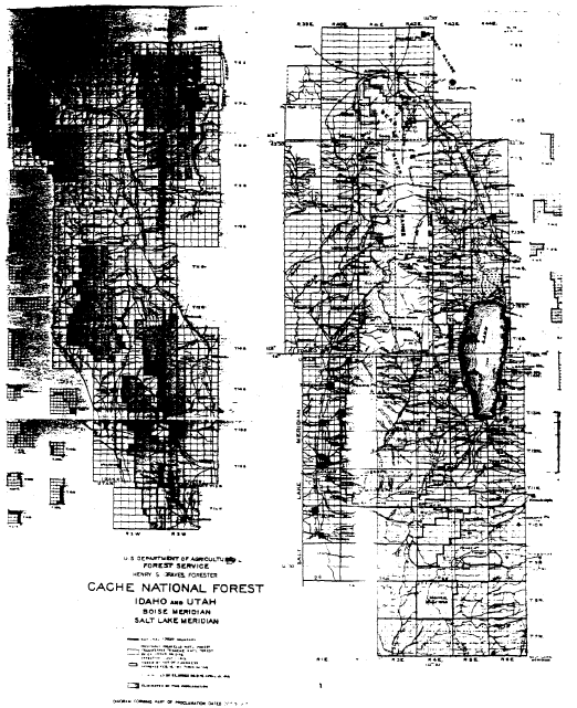
In 1907, all Forest Reserves were renamed as National Forests, so the Bear River Forest Reserve became the Bear River National Forest. The next change to come to the forest came on May 26, 1908. By Proclamation, the forest was split and renamed again, effective July 1, 1908. The western portion of the Bear River National Forest was transferred to the Pocatello National Forest and the remainder of the Bear River National Forest was renamed Cache National Forest. This transfer left Cache National Forest with 533,840 acres of land.
Executive Order 802 – Abolishment of Bear River and Est. of Cache
It is hereby ordered that on and after July 1, 1908, the land within the boundary shown on the attached diagram heretofore set apart, reserved, and proclaimed as part of the Bear River National Forest shall be known as the Cache National Forest. The remaining portions of the Bear River National forest shall continue reserved and constitute a part of the Pocatello National forest, as directed by my order of that date.
It is not intended by this order to release any land from reservation or to reserve any land not heretofore embraced in a National forest.
Theodore Roosevelt.
May 26, 1908.
On July 1, 1915 the entirety of Pocatello National Forest (298,868 acres) was transferred to the Cache National Forest, now approximately 832,708 acres.
The forest underwent several other small expansions through the years, but was ultimately divided again in 1973. At that time, the western portion was officially transferred to Caribou National Forest in Idaho. The Idaho portion of the remaining half was transferred to Caribou for administrative reasons but still bears the Cache name and was never fully transferred. The remainder of the Cache National Forest was merged with the Wasatch National Forest, becoming the Wasatch-Cache National Forest.
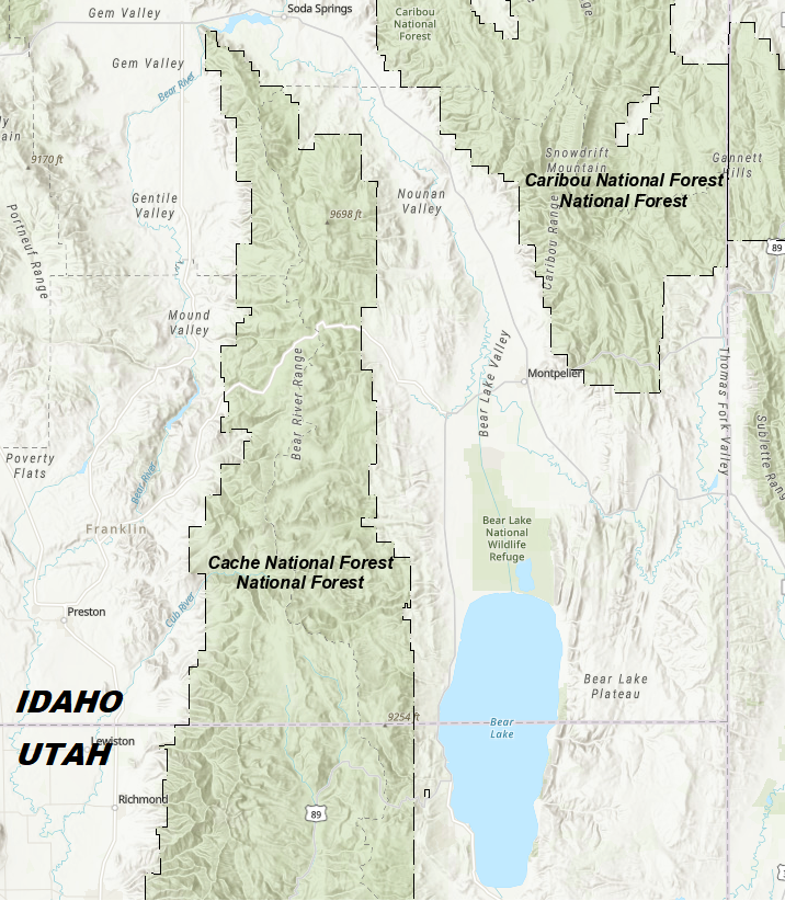
In August 2007, the forest underwent another merger becoming the Uinta-Wasatch-Cache National Forest containing 2,487,896 acres. Today the Utah portion of Cache is managed from the Logan Ranger District and consists of 701,453 acres, which contain two Wilderness Areas: Mount Naomi Wilderness Area and Wellsville Mountain Wilderness Area.
